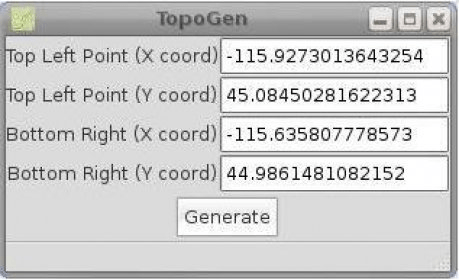
TopoGen is a small PyGTK application which will make a topographic image overlay for Google Earth using the given coordinate boundaries.
Very easy to use and very useful for users that are using everyday Google Earth.
TopoGen - Utility that makes a topographic image for Google Earth.

Military Overlay Editor (MOLE) is a set of COM components for developers


Comments